 ✨ AI Generated
Keage Incline
Japanese: 蹴上インクライン
Sakyo Ward, Kyoto
This information was written by AI and may contain mistakes. Please check official sources for opening hours, fees, and other details before you go.
Found a mistake? Let us know with “✏️ Something's wrong” on this spot's screen in asobot →
🎧 Audio guide(1:02)
In short
The remains of an inclined railway about 582 meters in total length that connected the upstream Keage Boat Basin with the downstream Nanzen-ji Boat Basin of the Lake Biwa Canal; at the time of its construction, it was the longest in the world. Completed in 1890 (Meiji 23), it was restored in 1977 (Showa 52) after operations were suspended in 1948 (Showa 23). In 2025, it was designated a National Treasure as one of the Lake Biwa Canal facilities.
- Walking on the Rails: The form of the rails is preserved, and you can walk freely inside the incline. Restored carts and a Sanjikkokubune Boat are also preserved
- Spring Cherry Blossoms: In spring, cherry blossoms on both sides of the incline bloom in full glory
- Nejiri-manpo Tunnel: A brick tunnel passing beneath the railway tracks, with its bricks laid in a spiral to increase its strength
History and Highlights
The Keage Incline is the remains of an inclined railway about 582 meters in total length that connected the upstream Keage Boat Basin with the downstream Nanzen-ji Boat Basin of the Lake Biwa Canal. At the time of its construction, it was the longest in the world. To overcome an elevation difference of about 36 meters, boats were loaded onto carts and transported using the same principle as a cable car. This allowed boats to navigate the elevation difference without unloading and loading their cargo.
The Lake Biwa Canal was a waterway built starting in 1885 to revitalize Kyoto, which had declined following the Transfer of the Capital to Tokyo due to the Meiji Restoration. It was led by the third prefectural governor, Kitagaki Kunimichi, with Tanabe Sakuro serving as the chief design and supervising engineer. The incline was constructed as part of this canal project; it was completed in the 23rd year of the Meiji period (1890) and began operating in the 24th year of the Meiji period (1891). The carts securing the boats were moved up and down by wire-rope winches powered by hydroelectricity from the Keage Power Station. Keage Power Station is Japan's first hydroelectric power plant.
Afterward, boat transport declined significantly due to the impact of railways and other factors, and operations were suspended in the 23rd year of the Showa period (1948). The electrical equipment and rails were also removed, but it was restored in the 52nd year of the Showa period (1977) to preserve it as an industrial heritage site. In the 8th year of the Heisei period (1996), it was designated a National Historic Site along with the Suirokaku Aqueduct and the canal tunnel entrances, and in 2025, it was also designated a National Treasure as one of the Lake Biwa Canal facilities.
Viewing and Experience Highlights
- Walking on the Rails: Today, the form of the rails is preserved, and visitors can walk freely inside the incline. Restored carts and a Sanjikkokubune Boat are also preserved alongside the rails.
- Spring Cherry Blossoms: In spring, cherry blossoms on both sides of the incline bloom in full glory, creating a splendid view.
- Nejiri-manpo Tunnel: A brick tunnel passing beneath the railway tracks, formally called a "shakyokyo" (skew arch). To increase the strength of the tunnel that intersects diagonally with the road above, the bricks were laid in a spiral pattern. A tunnel passing beneath a railway is called a "manpo," and because it is twisted ("nejiri"), it came to be called the "Nejiri-manpo Tunnel."
Walking Tips
Exiting from the basement floor of the Lake Biwa Canal Museum toward the Nanzen-ji Boat Basin side allows you to walk directly onto the incline. Nearby Murin-an Garden is about 320 meters to the northwest, and Nanzen-ji Temple is about 370 meters to the northeast. Combining your walk with a visit to Murin-an Garden and the Suirokaku Aqueduct at Nanzen-ji Temple lets you enjoy the scenery left behind by the Meiji-period canal.
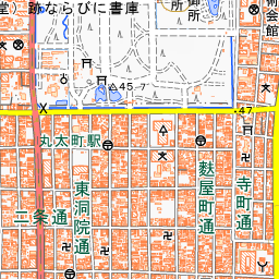


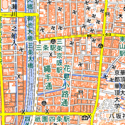


Spot location © OpenStreetMap contributors (ODbL)
Open in Google MapsGuides that include this spot (1)
Use asobot while you walk
- See where you are on the map and find spots nearby
- Listen to the guide's audio in course order, one after another (with subtitles)
- Walk to the next spot while following the map
Open on your phone
Scan to open this spot in asobot on your phone.