 ✨ AI Generated
Asuka Mizuochi Ruins
Japanese: 飛鳥水落遺跡
Asuka Village, Nara
This information was written by AI and may contain mistakes. Please check official sources for opening hours, fees, and other details before you go.
Found a mistake? Let us know with “✏️ Something's wrong” on this spot's screen in asobot →
🎧 Audio guide(1:01)
In short
The Asuka Mizuochi Ruins are the remains of Japan's oldest water clock tower, built in 660. Believed to be the site where Prince Naka no Oe installed the water clock (rokoku) mentioned in the Nihon Shoki, it has been designated a National Historic Site. It is one of the components of the "Ancient Capitals of Asuka and Fujiwara," inscribed on the World Heritage list in 2026.
- Restored Foundation Platform: A square stone foundation platform measuring 22.5 meters on each side has been restored, featuring 25 standing pillars.
- Original Paving Stones: The site is maintained so that the original paving stones around the foundation platform remain visible.
- Water Supply Conduits: Conduits have also been reconstructed in the likeness of the excavated copper pipes.
History and Highlights
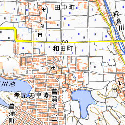
The Asuka Mizuochi Ruins are situated on the flat land along the Asuka River at the eastern foot of Amakashi Hill. A rokoku is a water clock, a device that measures the passage of time by the volume of water.
According to the Nihon Shoki, in the 6th year of the reign of Empress Saimei (660), Crown Prince Naka no Oe (later Emperor Tenji) made a water clock for the first time and used it to inform the populace of the time. Based on the location of the capital at that time, it is believed that this rokoku was set up here at the Asuka Mizuochi Ruins.
Part of the ruins was discovered in 1972 during a preliminary survey conducted prior to the construction of a private home, and the location was designated a Historic Site in 1976. Full-scale excavations from 1981 onward confirmed a building measuring four bays on each side with a stone-paved foundation. Inside the building, water-control facilities such as copper pipes, wooden troughs, and basins were discovered, along with a black-lacquered wooden box placed in the center.
The water clock is believed to have used tiered water tanks. The system operated by letting water flow from the top supply tank into the bottom receiving tank, observing time by the rise of the scale in the bottom tank. This technology is considered to have been introduced from Tang China. The advent of the water clock marked the introduction of a full-scale timekeeping system and can also be viewed as a symbol of the emperor's control over time.
This structure fell into disuse in the late 7th century. With the relocation of the capital to the Omi Otsu Palace, it is believed that the rokoku was also moved from Asuka to Otsu.
Viewing and Experiencing Points
- Stone-Paved Gutters and Platform: Crossing the bridge into the central area, you will find stone-paved gutters and an unusual subterranean beam construction preserved and reconstructed for visitors to view. Twenty-five pillars stand on the square stone foundation platform, which measures 22.5 meters per side, and the paving stones on all four outer sides of the platform are the original ones. The conduits directing the water have also been reconstructed based on the copper pipes excavated from the site.
- Virtual Asukakyo: Looking through the "Virtual Asukakyo" AR app provided by Asuka Village, the clock tower building appears atop the archaeological remains.
- Time Day: The annual Time Day on June 10 originates from an entry in the Nihon Shoki recording that a water clock was placed in the 10th year of Emperor Tenji's reign (671). The capital at that time was Omi, and traces of that specific water clock have not yet been found.
Walking Tips
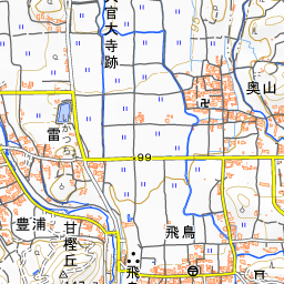
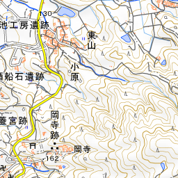
The site is right next to the "Asuka" bus stop. If you visit the Asuka Historical Museum first to see the full-scale replica of the water clock and the excavated copper pipes on display, the mechanism will be much easier to understand. The ruins are about 1 kilometer from the museum, roughly a 15-minute walk. Directly to the north of the ruins are the "Asuka Yume no Rakuichi" local produce market and the Asuka Village Buried Cultural Properties Exhibition Room, which uses the former Asuka Elementary School building. About 260 meters to the southeast is Asuka-dera Temple, and about 250 meters to the west-southwest is Amakashi Hill.

Guides that include this spot (1)
Use asobot while you walk
- See where you are on the map and find spots nearby
- Listen to the guide's audio in course order, one after another (with subtitles)
- Walk to the next spot while following the map
Open on your phone
Scan to open this spot in asobot on your phone.