 ✨ AI Generated
Mt. Mito
Japanese: 三頭山
Okutama Town, Tokyo
This information was written by AI and may contain mistakes. Please check official sources for opening hours, fees, and other details before you go.
Found a mistake? Let us know with “✏️ Something's wrong” on this spot's screen in asobot →
🎧 Audio guide(1:06)
In short
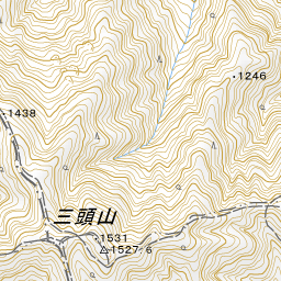
Mt. Mito is a mountain straddling Hinohara Village and Okutama Town. It features three peaks near the summit, with the highest reaching an elevation of 1,531 meters. It is one of the Okutama Sanzan (Three Mountains of Okutama) and also the highest mountain in Hinohara Village.
- Views from the summit: To the south, you can look out toward Mt. Fuji, and to the north, toward Mt. Kumotori, the highest peak in Tokyo. On clear winter days, the view extends all the way down to the foothills of Mt. Fuji.
- Beech forest with sparse bamboo grass: Said to be one of the few contiguous beech forests remaining in Tokyo, it has drawn academic attention due to its unusually sparse undergrowth of bamboo grass (sasa).
- Mito Falls and loop course: Starting from Hinohara Tomin-no-Mori (Tokyo Citizens' Forest), you can view Mito Falls head-on from Takimi Bridge and ascend to the summit via the beech trail.
History and Highlights
Mt. Mito spans Okutama Town, Hinohara Village, and the city of Uenohara and the village of Kosuge in Yamanashi Prefecture. Along with Mt. Otake and Mt. Gozen, it is known as one of the Okutama Sanzan. True to its name, it is a mountain with three summits that serves as the headwaters of the Aki River, with its highest point at an elevation of 1,531 meters. It is also the highest mountain in Hinohara Village.
Beautiful beech forests spread across the mountain slopes. It is said that the only remaining contiguous beech forests in Tokyo are on Mt. Mito and in the basin of the Nippara River. While beech forests typically have an understory of bamboo grass, the beech forest on Mt. Mito has very little, attracting academic interest. It is a forest where one can clearly witness the changing seasons through the fresh greenery of spring, the autumn foliage, and the fallen leaves of winter.
At the foot of the mountain stands a bridge bearing its name: Mito Bridge, located at the Okutama-side entrance of the Okutama Shuyu Road. The bridge was named after this famous Okutama peak, Mt. Mito.
Sights and Experiences
- Views from the summit: From the top, you can see Mt. Fuji to the south and Tokyo's highest peak, Mt. Kumotori, to the north. On clear winter days, the view reaches all the way to the foothills of Mt. Fuji. The view of Mt. Fuji from the west peak is also well known. The Okuchichibu Mountains and Tanzawa Mountains are visible as well.
- Mitosawa Stream terrace: Walking about 15 minutes along Mitosawa Stream from Mito Falls brings you to a terrace where you can take a rest while gazing at the flowing stream and the beech forest.
- Mito Falls: This waterfall is located farthest upstream in the Aki River system. It can be viewed up close directly from the front on Takimi Bridge, which crosses in front of the falls.
Hiking Tips
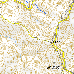
The main trailhead is at Hinohara Tomin-no-Mori (Tokyo Citizens' Forest). From the parking area, head toward the Forest Hall (Shinrin-kan) and walk along the woodchip-paved Otaki Trail. About 5 minutes in, there is a scenic viewpoint where, on a clear day, you can see the high-rise buildings of central Tokyo beyond the mountains. From Mito Falls, follow Mitosawa Stream along the beech trail up to Mushikari Pass; the summit is just a short distance from there. On the return trip, head down toward Saiguchi Pass; you can rest at an observation shelter along the way. This loop route is suitable for beginners to intermediates. On the Okutama side, near Kazahari Pass on the Okutama Shuyu Road, there is a hiking trail connecting Mt. Mito to Tokyo Metropolitan Okutama Lakeside Park Yama-no-Furusatomura. Because there are many northern slopes, snow takes a long time to melt once it falls. In winter, be sure to bring traction devices such as light crampons, along with a headlamp. Submit a hiking registration form and plan a trek within your physical limits.
Use asobot while you walk
- See where you are on the map and find spots nearby
- Listen to the guide's audio in course order, one after another (with subtitles)
- Walk to the next spot while following the map
Open on your phone
Scan to open this spot in asobot on your phone.