 ✨ AI Generated
Ogi District
Japanese: 大木地区
Izumisano, Osaka
This information was written by AI and may contain mistakes. Please check official sources for opening hours, fees, and other details before you go.
Found a mistake? Let us know with “✏️ Something's wrong” on this spot's screen in asobot →
🎧 Audio guide(1:08)
In short
A farming village situated in a small basin along the Kashii River, which has its source on Mt. Inunaki, in the mountainous area of Izumisano City. It was part of the Hine-no-sho Estate, a medieval estate of the Kujo family, and its scenery was designated as a national Important Cultural Landscape in 2013 under the title "Rural Landscape of Hine-no-sho Ogi." The place names, temples, and shrines appearing in old maps and historical records still remain today, which is considered valuable for showing the process of land development since the medieval period.
- Terraced Rice Fields Formed by Waterways: From the Edo period onward, paddies expanded onto the river terraces using water drawn from irrigation ponds and weirs on the Kashii River. Even today, 11 water systems remain, and terraced paddies spread across the slopes of Kami-Ogi and the higher areas at the foot of the mountains
- Distinctive Village Features of Ogi: Dotted around the paddies are sheds used for drying onions grown as a second crop, and many old bayberry (yamamomo) trees remain at the foot of the mountains. Stone-walled residential compounds line the roads, and thatched main houses still survive
- Hibashiri-jinja Shrine and Memories of Rainmaking: At Hibashiri-jinja Shrine, where villagers suffering from drought prayed for rain, the Hotaki ritual is still held today. A small subsidiary shrine on the grounds is designated as a national Important Cultural Property
History and Highlights
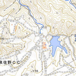
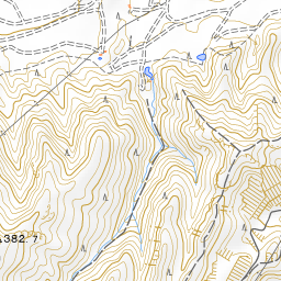
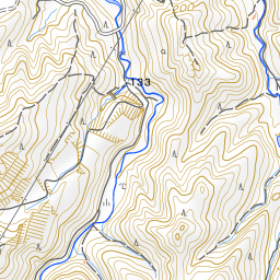
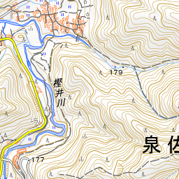
Ogi District is a farming village situated in a small basin along the Kashii River, which has its source on Mt. Inunaki, in the mountainous area of Izumisano City. Rice paddies and settlements developed along the old road leading to Kokawa in Kishu, and this scenery was designated as a national Important Cultural Landscape in 2013 under the title "Rural Landscape of Hine-no-sho Ogi."
This area was part of the Hine-no-sho Estate, which was owned by the Kujo family, one of the five regency houses (go-sekke) in medieval Japan. Hine-no-sho began in the second year of Tenpuku (1234) and lasted until the Tenbun era. During the Sengoku period (Warring States period), Kujo Masamoto came down to this land to protect his estate. He stayed for four years from 1501 at Chofuku-ji Temple, which was located in Ogi District at the time, leaving behind a daily account in his diary, Masamoto-ko Tabi-hikitsuke. The diary reveals that, in addition to rice, the villagers of that era produced brushwood, persimmons, bayberries (yamamomo), matsutake mushrooms, and other goods. Comparing the present landscape with the Ogi-mura Ezu (Map of Ogi Village) drawn in the Tenpo era of the Edo period shows that the current land use has remained largely unchanged since that time.
Ogi consists of three sections: Kami-Ogi, Naka-Ogi, and Shimo-Ogi. The place names, temples, and shrines appearing in old maps and historical records still remain today, which is considered valuable for showing the process of land development since the medieval period.
Viewing and Experience Highlights
- Terraced Rice Fields Formed by Waterways: In the medieval period, rice paddies were opened along valley streams where rainwater was easily collected. From the Edo period onward, paddies expanded onto the river terraces using water drawn from irrigation ponds and weirs on the Kashii River. Even today, 11 water systems remain. Terraced paddies spread across the slopes of Kami-Ogi and the higher areas at the foot of the mountains.
- Distinctive Village Features of Ogi: Dotted around the paddies are sheds used for drying onions, which are grown as a second crop. At the foot of the mountains behind the village, many old bayberry trees remain, having long been cultivated as a specialty. Stone-walled residential compounds line the roads, and thatched main houses still survive. On the gables of farmhouse roofs, decorations known locally as kiba ("fangs") or tsuno ("horns") can be seen.
- Hibashiri-jinja Shrine and Memories of Rainmaking: When suffering from drought, the villagers of Ogi prayed for rain at Hibashiri-jinja Shrine. Kujo Masamoto praised the Noh performance dedicated at that time, stating that it rivaled the Noh of the capital. The shrine still holds the Hotaki ritual today. A small subsidiary shrine on the grounds is designated as a national Important Cultural Property.
Tips for Exploring
To reach Ogi, take a bus bound for Mt. Inunaki from JR Hineno Station or Nankai Izumisano Station, and get off at "Naka-Ogi," which is right near Hibashiri-jinja Shrine. If you wish to trace the temples and shrines of the Hine-no-sho Estate, it is recommended to combine your visit with Jigen-in Temple and Hine-jinja Shrine, about 3.6 kilometers to the northwest, and Shipporyu-ji Temple on Mt. Inunaki, about 2.1 kilometers to the southeast. As this is a place where local residents live and cultivate their fields, please enjoy the scenery quietly from the roads.






Guides that include this spot (1)
Use asobot while you walk
- See where you are on the map and find spots nearby
- Listen to the guide's audio in course order, one after another (with subtitles)
- Walk to the next spot while following the map
Open on your phone
Scan to open this spot in asobot on your phone.