
Kobotoke Checkpoint
Japanese: 小仏関所
Hachioji, Tokyo
This information was written by AI and may contain mistakes. Please check official sources for opening hours, fees, and other details before you go.
Found a mistake? Let us know with “✏️ Something's wrong” on this spot's screen in asobot →
🎧 Audio guide(0:57)
In short
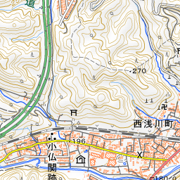
Kobotoke Checkpoint is the site of a barrier checkpoint located along the Old Koshu Kaido road in Ura-Takao-machi, Hachioji City. During the Edo period, it was said to be the most heavily fortified checkpoint along the Koshu Dochu highway. Today, designated as a National Historic Site under the name "Kobotoke Checkpoint Site," it still retains traces of the ancient highway.
- Tegata-ishi and Tetsuki-ishi: Although the buildings no longer stand, there remain the pass-stone where travelers placed their travel permits (tegata) and the hand-stone where they placed their hands while awaiting inspection.
- A Checkpoint from the Sengoku Period: It is said that Hojo Ujiteru first built a post atop Kobotoke Pass, and tradition holds that Tokugawa Ieyasu later moved and developed it at this current location.
- A Famous Plum Blossom Spot: Here lies Sekisho Bairin (Checkpoint Plum Grove), one of the Takao Plum Groves scattered along the Old Koshu Kaido.
History and Highlights
Kobotoke Checkpoint was said to be the most heavily fortified checkpoint along the Koshu Dochu highway during the Edo period. In 1928, its remains were designated as a National Historic Site under the name "Kobotoke Checkpoint Site."
Its beginnings date back to the Sengoku (Warring States) period. During the Tensho era, it is said that Hojo Ujiteru built it at the summit of Kobotoke Pass as a vital post along the border between Musashi and Sagami provinces. Timber from Mt. Takao was reportedly used in its construction. Later, the checkpoint was moved down to the foot of the pass. Following the downfall of the Hojo clan, Tokugawa Ieyasu, who entered the Kanto region in 1590 (Tensho 18), is said to have relocated and established it at its present site.
According to Edo-period pictorial maps, the checkpoint had gates on its east and west sides, and a guard post was situated on the north side of the grounds. Outside the east gate ran a river crossed by Komagino Bridge. Bamboo fences (takeyarai) were erected around the perimeter and the riverbed was deepened to monitor and control people traveling through. Around four guards generally guarded the checkpoint. They were granted residential plots nearby and were also people of culture who supported regional arts and traditions.
In 1869 (Meiji 2), checkpoints throughout the country were abolished by a decree of the Grand Council of State (Dajokan Fukoku), and the buildings of Kobotoke Checkpoint were demolished. In 1888 (Meiji 21), the route of the Koshu Kaido changed from passing over Kobotoke Pass to crossing Otarumi as it does today. Subsequently, momentum grew to preserve the old road, leading to its historic site designation.
Things to See and Experience
- Tegata-ishi and Tetsuki-ishi: Two stones that once stood in front of the building still remain today. The Tegata-ishi is the stone where travelers placed their travel permits. The Tetsuki-ishi is the stone where they rested their hands while waiting for their examination. Take a moment to imagine the travelers pausing their journeys right here.
- Vestiges of the Old Road: Located along the Old Koshu Kaido, the site still retains traces of the old highway. Traditional houses are dotted along the road, and the path heading toward the mountain pass also preserves the atmosphere of the ancient route.
- Sekisho Bairin: The Kobotoke Checkpoint site is also known as a prime spot for viewing plum blossoms. Over a stretch of roughly 4.5 kilometers along the Old Koshu Kaido, plum groves collectively called Takao Plum Groves—including Sekisho Bairin—are scattered about, with a total of around 10,000 red and white plum trees coming into bloom. They are usually at their best from mid-February to mid-March.
Travel Tips
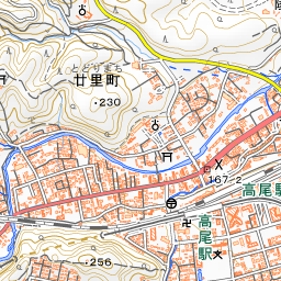
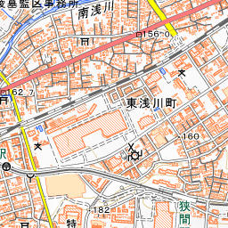
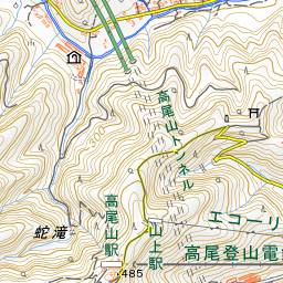
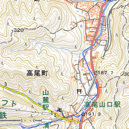
From the North Exit of JR Takao Station, take the Keio Bus bound for Kobotoke and get off at "Komagino," right nearby. The site can be viewed freely at any time, but there is no parking lot. Because the Old Koshu Kaido is narrow, please be mindful of passing buses when walking. About 360 meters to the east is Takao Komagino Garden, which makes for a pleasant stroll together. You can also extend your walk toward Mt. Takao or to Keio Takaosan Onsen Gokurakuyu, located about 1.1 kilometers to the south.
Use asobot while you walk
- See where you are on the map and find spots nearby
- Listen to the guide's audio in course order, one after another (with subtitles)
- Walk to the next spot while following the map
Open on your phone
Scan to open this spot in asobot on your phone.