 ✨ AI Generated
Tairo Pond
Japanese: 大路池
Miyake Village, Tokyo
This information was written by AI and may contain mistakes. Please check official sources for opening hours, fees, and other details before you go.
Found a mistake? Let us know with “✏️ Something's wrong” on this spot's screen in asobot →
🎧 Audio guide(1:12)
In short
Tairo Pond is a crater lake located in Tsubota in the southern part of Miyakejima Island, said to have been formed approximately 2,500 years ago. It is one of the largest freshwater lakes in the Izu Islands, surrounded by virgin forest of trees such as sudajii chinquapin. The forest is home to wild birds, including the Izu thrush, which is a national natural monument, and the path around the pond is called "Japan's Best Birdsong Path."
- Birdsong Path: Walk while listening to birdsong through a forest with a particularly large number of wild birds on the island.
- Forest of Giant Trees: A virgin forest extends with giant sudajii chinquapin trees, including the village-designated natural monument "Maigojii."
- Quiet Waterside: Standing on the pier on the north side, you can hear birdsong in the tranquility.
History and Highlights
Tairo Pond is a crater lake located in Tsubota in southern Miyakejima Island, said to have been formed by a phreatomagmatic explosion roughly 2,500 years ago. It is one of the largest freshwater lakes in the Izu Islands, with a circumference of 2.1 km. Filled with water throughout the year, it was once used as an important water source for the village's simplified water supply system.
From the waterside up the slopes, the area is covered by virgin forest of trees such as chinquapin. Because the area around Tairo Pond was little affected by the 2000 eruption, the forest containing giant sudajii chinquapin trees has grown well. Known as a paradise for small birds, this forest is designated as a wild bird protection area and a special protection zone of a national park.
Rare wild birds live in the forest, such as the national natural monument Izu thrush and the Iijima's leaf warbler. The Izu thrush is a thrush species endemic to Japan that breeds only in the Izu Islands and the Tokara Islands, and it has been chosen as the bird of Miyake Village. The area around Tairo Pond is a place with a particularly high concentration of wild birds on the island. The 2-kilometer path circling the pond is called "Japan's Best Birdsong Path."
An endemic aquatic plant called "tairomo" grew in this pond, which attracted attention when it was discovered in 1937. However, a large amount of volcanic ash fell during the 1983 eruption, and it is now considered to be in danger of extinction. In May 1937, the author Dazai Osamu also visited Tairo Pond. A photograph of him resting by the lakeside remains.
Viewing and Experience Tips
- Listen to birdsong: Try listening to the chirping of forest birds while walking along the path around the pond. Having binoculars makes it easier to look for wild birds like the Izu thrush.
- Visit Maigojii: In the forest of giant trees around Tairo Pond stands the giant sudajii chinquapin tree "Maigojii." It is a tree about which it has been said that even if you get lost in the forest, aiming for this massive tree will surely save you. For centuries, it has been revered as a sacred tree governing volcanic eruptions. With a trunk circumference of 7.5 meters and a height of 15 meters, it is a village-designated natural monument.
- View the pond from the pier: Standing on the pier on the north side, birdsong can be heard in the quiet. There is also an information board marking the visit of Dazai Osamu.
Walking Advice
At the entrance to the pond is the Miyakejima Nature Center Akakokko-kan. It is a village nature observation facility established in 1993, staffed by rangers from the Wild Bird Society of Japan. It is recommended to first learn about birdwatching spots and the island's nature here before heading to the pond. Akakokko-kan is a 2-minute walk from the "Tairoike" bus stop. On the north side of the pond, there is a park area managed by the Tokyo Metropolitan Government, equipped with a rest area, restrooms, and parking. Maigojii can also be reached by car. About 1.2 km east of the pond lies Chotaro Pond.


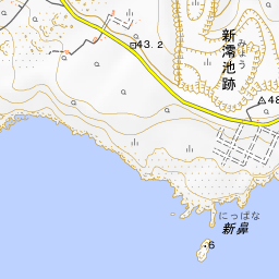


Spot location © OpenStreetMap contributors (ODbL)
Open in Google MapsGuides that include this spot (1)
Use asobot while you walk
- See where you are on the map and find spots nearby
- Listen to the guide's audio in course order, one after another (with subtitles)
- Walk to the next spot while following the map
Open on your phone
Scan to open this spot in asobot on your phone.