 ✨ AI Generated
Shikinejima Island
Japanese: 式根島
Niijima Village, Tokyo
This information was written by AI and may contain mistakes. Please check official sources for opening hours, fees, and other details before you go.
Found a mistake? Let us know with “✏️ Something's wrong” on this spot's screen in asobot →
🎧 Audio guide(1:04)
In short
Shikinejima Island is a small volcanic island located southwest of Niijima Island in the Izu Islands. With a circumference of approximately 12 kilometers, it can be explored on foot. The island is known for its calm waters along a ria coast and hot springs bubbling up among the rocks. It had no permanent residents during the Edo period, and settlement and development began in 1887.
- Tomari Beach: The island's signature beach, featuring white sand and turquoise-blue waters.
- Rocky Hot Springs: There are three open-air baths requiring swimsuits, including Jinata Onsen, situated in terrain that appears split open as if by a hatchet.
- Kanbiki Observation Deck: Offers stunning views of the coastline, as well as clear starry skies after sunset on clear days.
History and Highlights
Shikinejima Island is a volcanic island situated southwest of Niijima Island in the Izu Islands. It lies about 160 kilometers south of Tokyo and is approximately 3 hours away by high-speed jetfoil. Covering an area of 3.7 square kilometers, it has a circumference of roughly 12 kilometers. The entire island consists of a lava plateau with an indented coastline, and it is enveloped in lush greenery.
The island's history stretches far back, with numerous artifacts from the middle Jomon period uncovered at archaeological sites on the island. In contrast, there were no permanent residents during the Edo period. It appears to have served as a temporary harbor for ships transporting exiles to Niijima Island and Hachijojima Island, an ad-hoc salt production site for tax payments, a spa area for therapeutic bathing, and a fishing ground. Tomari Bay has been used as a natural port since as early as the Muromachi period.
Settlement and development began in 1887. On the volcanic Shikinejima Island, securing water was a critical challenge for permanent settlement. Starting in 1890, it took three years for fewer than 20 islanders and supporters from Niijima Island to complete the Maimaizu Well. This style of well is built by digging a mortar-shaped depression into the ground and sinking a well shaft at the bottom. It earned its name because the spiral path leading down resembles a snail (maimai). A settlement gradually formed around this well.
There is a widespread story that the island separated from Niijima Island due to the massive tsunami of the 1703 Genroku earthquake. However, an old map created the year before clearly depicts Niijima Island and Shikinejima Island as separate entities. Furthermore, no historical documents recording such a separation have been found to date.
Highlights & How to Experience
- Tomari Beach: A particularly popular beach on the island. It features white sand and turquoise-blue waters, with shallow depths and gentle waves.
- Rocky Hot Springs: There are three open-air hot spring baths where you enter wearing a swimsuit. The most prominent is Jinata Onsen, set in terrain resembling a fissure cleaved by a hatchet. For details, please consult the guide for Jinata Onsen.
- Observation Deck and Starry Skies: For breathtaking views of the coastline, head to Kanbiki Observation Deck, which was selected as one of the New Hundred Views of Tokyo. After sunset on clear days, you can also gaze at clear, star-filled skies.
Travel Tips
There are no buses or taxis on the island. Since most places are within an hour's walk, renting a bicycle is an efficient way to get around. Tomari Beach is a 5-minute walk from Nobushi Port. If you enjoy hiking, there is the approximately 2-hour "Forest and Volcano Road" that leads toward the sheer cliffs of Tojinzushiro. As streetlights are sparse at night, be sure to carry a flashlight when going to view the stars. Niijima Island can be reached in about 10 minutes aboard the "Nishiki" ferry.







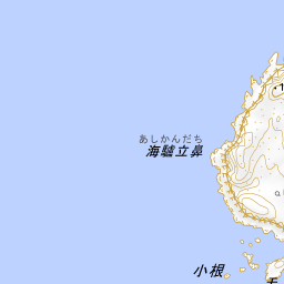



Spot location © OpenStreetMap contributors (ODbL)
Open in Google MapsGuides that include this spot (1)
Use asobot while you walk
- See where you are on the map and find spots nearby
- Listen to the guide's audio in course order, one after another (with subtitles)
- Walk to the next spot while following the map
Open on your phone
Scan to open this spot in asobot on your phone.