 ✨ AI Generated
Great Strata Cross-Section
Japanese: 地層大切断面
Oshima Town, Tokyo
This information was written by AI and may contain mistakes. Please check official sources for opening hours, fees, and other details before you go.
Found a mistake? Let us know with “✏️ Something's wrong” on this spot's screen in asobot →
🎧 Audio guide(1:00)
In short
The Great Strata Cross-Section is a massive cross-section of geological strata that appears along the Oshima Ring Road in the southwestern part of Izu Oshima. It was exposed in 1953 when the hillside was carved away during road construction. It is a striped pattern formed by the accumulation of ejecta from more than 100 major eruptions over the past approximately 18,000 years, and is affectionately known as the "baumkuchen."
- Large Striped Pattern: A cross-section about 24 meters high and 630 meters long stretches along the road.
- Wavy Strata: Because the ejecta accumulated so as to drape over the undulating topography, it waves dramatically.
- Traces of Caldera Eruption: At the upper part of the western end, rock blocks hurled by a phreatic eruption about 1,700 years ago are embedded.
History and Highlights
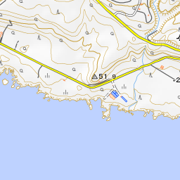
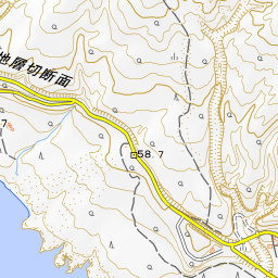
The Great Strata Cross-Section is located along the Oshima Ring Road, which runs through the southwestern part of the island. It is also called the Semba Strata Section. Measuring approximately 24 meters in height and 630 meters in length, this cross-section is affectionately nicknamed "baumkuchen" due to its appearance.
For a long period, travel between Nomashi and Habu Port on Izu Oshima was carried out by boat. In 1953 (Showa 28), when the hillside was cut away for road construction, this massive striped pattern was revealed.
These stripes are geological layers formed by the accumulation of deposits from more than 100 major eruptions that occurred repeatedly over the past approximately 18,000 years. The interval between eruptions was 100 to 200 years. This shows that eruptive activity similar to that of today has continued since that time.
The basic pattern consists of alternating layers of scoria and volcanic ash carried by the wind during eruptions, and soil formed during quiet periods. These three layers are considered a single unit representing one active period.
Research on the volcano of Izu Oshima—said to be the most thoroughly understood volcano in the world—is reportedly largely indebted to the analysis of this cross-section.
Viewing and Experience Points
- Count a Single Period of Activity: Try following the stripes in front of you as a single unit composed of scoria, volcanic ash, and soil. The black layer is a scoria layer from an eruption that occurred on land. The layer beneath it is from an eruption that occurred near sea level.
- Reason for the Wavy Shape: The dramatic waving of the strata is not due to tectonic folding. It is because the ejecta fell and settled over pre-existing undulating terrain. Unconformities in several layers are believed to have been caused by collapses due to earthquakes, heavy rain, or other factors.
- Rock Blocks at the Upper Western End: At the upper western end, one can see areas where rock blocks are embedded, as well as a layer mixed with angular rock fragments and sediment. These consist of rock blocks blasted out and deposits from pyroclastic flows that swept down during the phreatic eruption approximately 1,700 years ago that formed the present caldera.
Walking Tips
It is about a 15-minute drive from Motomachi Port. The nearest bus stop is appropriately named "Chiso Danmen-mae," and its design is modeled after a baumkuchen. A model course for the Geopark involves driving from the southeastern part of the island toward the west, stopping here after Suna-no-Hama Beach, and returning to Motomachi Port. The appearance of the strata changes with the weather and seasons, and in autumn and winter, it can be seen bathed in the glow of the setting sun. Over the sea to the west, you can see Toshima Island, Niijima Island, Shikinejima Island, and Kozushima Island. To the south, depending on the weather, Miyakejima Island and Mikurajima Island can also be viewed. Mt. Mihara is about 3 kilometers to the northeast, and Habu Port is about 6 kilometers to the east-southeast.




Guides that include this spot (1)
Use asobot while you walk
- See where you are on the map and find spots nearby
- Listen to the guide's audio in course order, one after another (with subtitles)
- Walk to the next spot while following the map
Open on your phone
Scan to open this spot in asobot on your phone.