 ✨ AI Generated
Daikandai-ji Temple Site
Japanese: 大官大寺跡
Asuka Village, Nara
This information was written by AI and may contain mistakes. Please check official sources for opening hours, fees, and other details before you go.
Found a mistake? Let us know with “✏️ Something's wrong” on this spot's screen in asobot →
🎧 Audio guide(1:03)
In short
The Daikandai-ji Temple Site marks the remains of a state temple from the era of Fujiwara-kyo. It was the largest temple in the "Asuka-Fujiwara" area, and its nine-story pagoda was a symbol of the state. Today, slight traces of the foundation platforms remain in the paddy fields at the southern foot of Mt. Amanokagu. It is one of the component parts of the World Cultural Heritage property "Ancient Capitals of Asuka and Fujiwara."
- A Giant Nine-Story Pagoda: The foundation platform measured about 35 meters on each side, and while the pagoda's height is unknown, it is thought to have been close to 100 meters.
- Kondo and Kodo Rivaling the Daigokuden: Both structures had a facade of about 45 meters, matching the scale of the Fujiwara Palace Daigokuden (Great Hall of State).
- Lost to Fire Before Completion: It was destroyed by a fire in 711, at which time the pagoda and middle gate appear to have still been under construction.
History and Highlights
Daikandai-ji Temple was a state temple deliberately positioned to the southeast of Fujiwara Palace. It was the largest temple in "Asuka-Fujiwara," and its nine-story pagoda in particular served as a national symbol. Until Emperor Shomu built Todai-ji Temple, it held the position of the foremost temple of the state.
According to the Nihon Shoki, Emperor Tenmu moved Emperor Jomei's Kudara-no-Odera Temple to the Asuka area in the 2nd year of Tenmu (673) and named it Takechi-no-Odera Temple, then renamed it Daikandai-ji Temple in the 6th year of Tenmu (677). The name signifies the "temple of the emperor." However, archaeological excavations have confirmed that the temple layout of the current site dates to the era of Emperor Monmu, leading to the belief that the Takechi-no-Odera Temple of Emperor Tenmu's era stood in a different location.
The temple grounds spanned about 205 meters east-west and about 354 meters north-south. The layout featured the middle gate, the kondo (main hall), and the kodo (lecture hall) arranged in a straight line from south to north, with the pagoda located to the southeast of the kondo. The kondo and kodo were of identical scale, each measuring about 45 meters across the front, matching the scale of the Fujiwara Palace Daigokuden. The foundation platform of the pagoda was about 35 meters on each side. While the height of the pagoda is not known, it is considered to have been close to the roughly 100 meters of the east pagoda of Todai-ji Temple, which had a similar ground plan.
The temple was relocated with the transfer of the capital to Heijo-kyo and became Daian-ji Temple. The former temple at Fujiwara-kyo was struck by a fire in 711, destroying the kondo, kodo, pagoda, middle gate, and cloister corridors. At that time, only the kondo and kodo had been completed, and the pagoda and middle gate appear to have still been under construction. Excavations revealed that rafters from the kondo and middle gate burned, fell, plunged into the ground, and continued burning thereafter.
Highlights for Viewing and Experiencing
- Foundation Traces in Paddy Fields: Traces of the foundation platforms of the nine-story pagoda and kondo remain faintly in the paddy fields at the southern foot of Mt. Amanokagu. A stone monument stands here, indicating the temple's location.
- Removed Foundation Stones: Foundation stones remained at the sites of the kondo and the pagoda until the mid-Meiji period. However, they were carried away in 1889 during the construction of Kashihara-jingu Shrine.
- Temple Structures Preserved in Place Names: In excavation records, small sub-ward names like "To-no-i" (Well of the Pagoda), where the pagoda's earthen mound sits, and "Kodo" (Lecture Hall) can be found. The names of the buildings have thus become localized place names.
Walking Tips
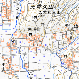
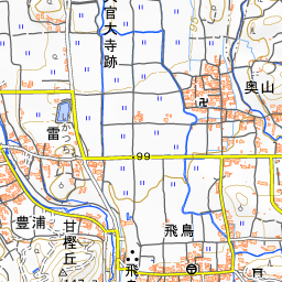
The site straddles Koyama in Asuka Village and Minamiuracho in Kashihara City, with most of the temple grounds located within Asuka Village. Standing before the monument, imagine the pagoda platform measuring about 35 meters on each side and the roughly 45-meter-wide kondo rising over the paddy fields. Since this is a historic site situated among paddy fields, please walk carefully without stepping into farmland. Asuka Historical Museum is located about 790 meters to the southeast, and Asuka-dera Temple is located about 1.1 kilometers to the south.

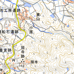
Spot location © OpenStreetMap contributors (ODbL)
Open in Google MapsGuides that include this spot (1)
Use asobot while you walk
- See where you are on the map and find spots nearby
- Listen to the guide's audio in course order, one after another (with subtitles)
- Walk to the next spot while following the map
Open on your phone
Scan to open this spot in asobot on your phone.