 ✨ AI Generated
Amakashi Hill
Japanese: 甘樫丘
Asuka Village, Nara
This information was written by AI and may contain mistakes. Please check official sources for opening hours, fees, and other details before you go.
Found a mistake? Let us know with “✏️ Something's wrong” on this spot's screen in asobot →
🎧 Audio guide(1:02)
In short
Amakashi Hill is a low hill with an elevation of about 148 meters located on the west bank of the Asuka River, and forms the Amakashi Hill District of Asuka Historical National Government Park. It is known for its observation deck offering panoramic views of the Fujiwara-kyo site and the Yamato Sanzan Mountains. The Nihon Shoki records that the residences of the father and son Soga no Emishi and Soga no Iruka were built here.
- Summit Observation Deck: The Amakashi Hill Observation Deck has open views to both the east and west, overlooking the hamlets of Asuka Village to the east, and the Yamato Sanzan Mountains along with distant mountain ranges to the west.
- The Story of the Soga Clan Residence: The Amakashi-no-oka Toroku Ruins at the eastern foot have been conjectured to possibly be the residence of the Soga clan. However, this has not been confirmed.
- Manyo Botanical Path: You can walk along this path while answering quizzes on the names of about 40 varieties of plants that appear in classic literature such as the Manyoshu.
History and Highlights
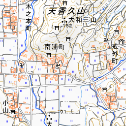
Amakashi Hill is a low hill standing about 148 meters above sea level on the west bank of the Asuka River. Today, it is maintained as the Amakashi Hill District of Asuka Historical National Government Park. While the highest point of the hill is now called Amakashi Hill, it is believed that in ancient times the name referred to the entire low hilly ridge running along the Asuka River.
It also appears in ancient historical chronicles. During the reign of Emperor Ingyo, it is said that kukatachi (trial by boiling water) was performed here to rectify the confusion over family clan names. The account tells of judging truth or falsehood by having people plunge their hands into a cauldron of boiling water.
According to the Nihon Shoki, in 644, the third year of Empress Kogyoku's reign, the residences of the father and son Soga no Emishi and Soga no Iruka were built on Amakashi Hill. It is said that they built houses side by side, and fortified them by constructing palisades and an armory. Soga no Iruka was later slain in the Isshi Incident of 645.
At the Amakashi-no-oka Toroku Ruins at the eastern foot of the hill, the Nara National Research Institute for Cultural Properties has conducted repeated archaeological excavations. From a mid-7th-century burned soil layer, large quantities of earthenware fragments, burned wall clay, and charred wood have been excavated. A stone wall dating from the early to mid-7th century was also confirmed over a length of about 34 meters. In one excavation, it was found that an older group of buildings fell out of use around the time of the Taika Reform, which was considered to heighten the possibility of it being the Soga residence. Even so, the discovered buildings were storehouse-like structures and small-scale ones, and the report states that it is premature to conclude that they are part of the residence.
Viewing and Experience Points
- Views to the East and West: To the east of the Amakashi Hill Observation Deck, you can see the hamlets of Asuka Village lined with tiled roofs. To the west rises Mt. Unebi, backed by Mt. Nijo. You can also overlook the Yamato Sanzan Mountains, which form a triangle around Fujiwara-kyo: Mt. Unebi to the west, Mt. Miminashi to the north, and Mt. Amanokagu to the east.
- Bronze Plate at the Kawahara Observation Deck: At the other viewpoint, the Kawahara Observation Deck, there is a bronze plate embedded in natural stone. It is engraved with "Yamato Kunihara Bokei" (View of the Yamato Plains), indicating the names of the mountains and historical sites visible in all four directions.
- Manyo Botanical Path: There are quizzes where you can guess the names of about 40 kinds of plants. The system allows you to discover the plant's name by flipping over the question plate.
Walking Tips
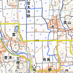
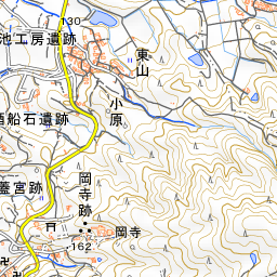
From the "Amakashi-no-oka" bus stop, it is a 15-minute walk to the northern Amakashi Hill Observation Deck, and a 10-minute walk to the southern Kawahara Observation Deck. Asuka-dera Temple can also be looked down upon from the observation deck. Asuka-dera Temple is located about 430 meters east-southeast, and the Asuka Mizuochi Ruins are about 250 meters east-northeast. For a walking tour, a suggested itinerary starts at the Ishibutai Kofun Burial Mound, passes through the Asuka Palace Site, Asuka-dera Temple, and the Asuka Mizuochi Ruins, finishing with the panoramic view from Amakashi Hill.

Guides that include this spot (1)
Use asobot while you walk
- See where you are on the map and find spots nearby
- Listen to the guide's audio in course order, one after another (with subtitles)
- Walk to the next spot while following the map
Open on your phone
Scan to open this spot in asobot on your phone.