 ✨ AI Generated
Amagase Dam
Japanese: 天ヶ瀬ダム
Uji, Kyoto
This information was written by AI and may contain mistakes. Please check official sources for opening hours, fees, and other details before you go.
Found a mistake? Let us know with “✏️ Something's wrong” on this spot's screen in asobot →
🎧 Audio guide(0:54)
In short
A multipurpose dam near the urban area of Uji, and the only dam on the Uji River, which is the main stem of the Yodo River. It was completed in 1964 as the oldest dam within the Yodo River system and serves three roles: flood control, power generation, and the supply of drinking water.
- Dome-Shaped Arch Dam: It stands 73 meters high with a crest length of 254 meters, placing the crest at roughly the same height as the main keep of Osaka Castle
- Lake Hoo: Because its shape resembles a phoenix spreading its wings, the reservoir is called "Lake Hoo"
- Touring the Crest Pathway: Visitors can tour freely simply by writing their name and party size at the dam's entrance. With an advance application, it is also possible to view the dam from below the structure, an area ordinarily off-limits
History and Highlights
Amagase Dam is a multipurpose dam located on the Uji River, near the urban area of Uji. It is the only dam on the Uji River, which is the main stem of the Yodo River, and was completed in 1964 as the oldest dam within the Yodo River system. Serving three roles—flood control, power generation, and the supply of drinking water—its gates are operated by the Amagase Dam Management Branch Office of the Ministry of Land, Infrastructure, Transport and Tourism's Yodo River Dams Integrated Management Office.
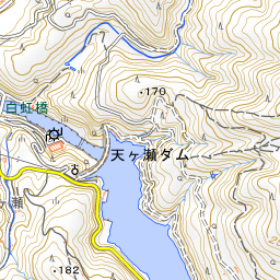
In terms of structure, it is a dome-shaped arch dam whose wall is built in an arch so that the water pressure of the impounded water is supported by the bedrock on both sides. It stands 73 meters high with a crest length of 254 meters, placing the crest at roughly the same height as the main keep of Osaka Castle. Because its shape resembles a phoenix spreading its wings, the reservoir is called "Lake Hoo".
Under the Amagase Dam Redevelopment Project, a 617-meter tunnel-style discharge facility was built on the left bank to increase the dam's discharge capacity, with management beginning in April of Reiwa 5 (2023).
Viewing and Experience Highlights
- 254-Meter Crest Pathway: Visitors can tour freely simply by writing their name and party size at the dam's entrance. The pathway along the curved crest spans 254 meters, and beyond it, on the right bank, you can see the mountain ridges of Amagase Forest Park. Note that there are no restrooms on the opposite side of the pathway.
- Discharge and Grand Views: Visitors can enjoy water discharges and grand views from the dam. With an advance application, it is also possible to view the dam from below the structure—an area ordinarily off-limits—or actually walk through the management corridors.
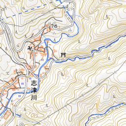
- Highlights Around the Dam: Downstream on the Uji River stands Hakuko Bridge, designed to harmonize with the scenery of Amagase Dam. The brick building seen downstream on the right bank is the former Shizugawa Power Station, which ceased operations upon the completion of Amagase Dam. Amagase Forest Park offers a panoramic view overlooking the dam.
Tips for Exploring
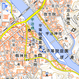
It is about a 40-minute walk (3.3 km) from Uji Station on the Keihan Uji Line, and about a 50-minute walk (3.8 km) from Uji Station on the JR Nara Line. As there is no general public parking at the dam, visitors should refrain from arriving by car. Entry is not permitted when passage across the dam body is obstructed due to construction or other work. Along the Uji River are Byodo-in Temple, Ujigami-jinja Shrine, and Kosho-ji Temple (known for its autumn foliage), allowing visitors to enjoy a stroll in combination with touring the dam. Dam Cards can be requested at the dam entrance.
Use asobot while you walk
- See where you are on the map and find spots nearby
- Listen to the guide's audio in course order, one after another (with subtitles)
- Walk to the next spot while following the map
Open on your phone
Scan to open this spot in asobot on your phone.