 ✨ AI Generated
Maruyama Park
Japanese: 円山公園
Higashiyama Ward, Kyoto
This information was written by AI and may contain mistakes. Please check official sources for opening hours, fees, and other details before you go.
Found a mistake? Let us know with “✏️ Something's wrong” on this spot's screen in asobot →
🎧 Audio guide(1:16)
In short
The oldest park in Kyoto City, opened in 1886 (Meiji 19). Surrounded by the temples and shrines of Higashiyama, such as Yasaka-jinja Shrine, Chion-in Temple, and Kodai-ji Temple, it was designated a national Place of Scenic Beauty in 1931 (Showa 6).
- Gion Weeping Cherry: The "Gion no Yozakura" standing in the center of the park. The current tree is the second generation, grown by Sano Toemon XV from a seed collected from the first-generation tree, which died in 1947 (Showa 22), and planted in 1949 (Showa 24)
- Garden by Ueji: A garden built from 1913 (Taisho 2) to the following year by Ogawa Jihei VII (Ueji), drawing water from the Second Sosui Canal. The stream flows from a waterfall stone arrangement into the Hyotan-ike Pond, and the view of Mt. Kacho is incorporated as borrowed scenery
- Statues of Sakamoto Ryoma and Nakaoka Shintaro: The bronze statues, erected in 1934 (Showa 9), were lost during wartime metal collections, and were rebuilt in 1962 (Showa 37) by an association of people from Kochi Prefecture
History and Highlights
Opened in 1886 (Meiji 19), Maruyama Park is the oldest park in Kyoto City. It is bordered by the foothills of Higashiyama to the east, Yasaka-jinja Shrine to the west, Kodai-ji Temple to the south, and Shoren-in Temple and Chion-in Temple to the north. In 1931 (Showa 6), it was designated a national Place of Scenic Beauty.
From before the Kamakura period, this area was a wilderness known as Makuzugahara, overgrown with Japanese arrowroot and silver grass. The name Maruyama is said to derive from Jienzan, the mountain name (sango) of Anyo-ji Temple. During the Edo period, sub-temples of the Ji sect known as the Rokuami stood within the grounds of Anyo-ji Temple. Each operated rental banquet rooms where people could enjoy poetry, songs, and feasts amid splendid views, making it known as a scenic destination. After the land in this area was returned to the government under the Jochirei (orders for the confiscation of temple and shrine lands) in the early Meiji period, Kyoto Prefecture opened the park, and its management was transferred to Kyoto City in 1889 (Meiji 22).
Highlights for Viewing and Experiencing
- Gion Weeping Cherry: Standing in the center of the park, this cherry tree is commonly known as "Gion no Yozakura" (the night cherry blossom of Gion), and its official name is Hitoe Shirohigan Shidarezakura. The first-generation tree was designated a national Natural Monument, but it died in 1947 (Showa 22). The current tree was grown from a seed collected from the original tree by Sano Toemon XV and planted in 1949 (Showa 24); it delights many visitors during the cherry blossom viewing season.
- Garden by Ueji: During improvement works carried out between 1913 (Taisho 2) and the following year, Ogawa Jihei VII, commonly known as Ueji, built a garden with the theme of flowing water, drawing water from the Second Sosui Canal. A waterfall stone arrangement evoking a natural ravine leads the flow into the Hyotan-ike Pond, which features a boat landing and incorporates the view of Mt. Kacho as borrowed scenery (shakkei).
- Statues of Sakamoto Ryoma and Nakaoka Shintaro: The bronze statues of the two figures, erected in 1934 (Showa 9), were lost during wartime metal collections, and were rebuilt in 1962 (Showa 37) by an association of people from Kochi Prefecture. A monument inscribed with the song "Gion Kouta" also stands within the park.
Walking Tips
It is about a 10-minute walk from Keihan Gion-Shijo Station. Because it connects directly to Yasaka-jinja Shrine, Chion-in Temple, and Kodai-ji Temple, it is also well suited for taking a break while touring the temples and shrines of Higashiyama.
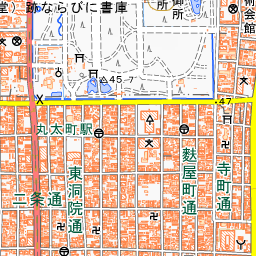


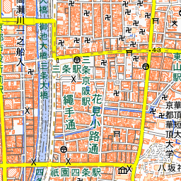


Spot location © OpenStreetMap contributors (ODbL)
Open in Google MapsGuides that include this spot (1)
Use asobot while you walk
- See where you are on the map and find spots nearby
- Listen to the guide's audio in course order, one after another (with subtitles)
- Walk to the next spot while following the map
Open on your phone
Scan to open this spot in asobot on your phone.