 ✨ AI Generated
Mt. Mitake
Japanese: 御岳山
Ome, Tokyo
This information was written by AI and may contain mistakes. Please check official sources for opening hours, fees, and other details before you go.
Found a mistake? Let us know with “✏️ Something's wrong” on this spot's screen in asobot →
🎧 Audio guide(1:04)
In short
Mt. Mitake is a 929-meter-high mountain located in Ome City that has been revered since ancient times as a sacred mountain. Musashi Mitake-jinja Shrine stands at the summit, and near it lies a settlement of shukubo (pilgrim lodgings) run by the families of Shinto priests. The deep forest covering the mountain is part of Chichibu-Tama-Kai National Park, and visitors can ascend via cable car.
- Cable Car: Climbs an elevation difference of 424 meters from Takimoto Station to Mitakesan Station in just 6 minutes.
- Shukubo Settlement: The lodgings that have welcomed worshipers since the Edo period continue atop the mountain today.
- Forest and Flowers: Features the large Jindai Zelkova along the approach and a colony of false anemones (renge-shoma) that bloom in summer.
History and Highlights
Mt. Mitake is a 929-meter-high mountain located in Ome City. It has been revered since ancient times as a sacred mountain, and Musashi Mitake-jinja Shrine sits at its peak. The deep forest blanketing the mountain forms part of Chichibu-Tama-Kai National Park.
Near the summit lies a small settlement where Shinto priests of Musashi Mitake-jinja Shrine and their families operate shukubo lodgings. During the Edo period, priests known as oshi spread religious associations (ko) and welcomed many worshipers. Shukubo from that era continue today and also accept general overnight guests. The Baba Family Oshi Residence, built in 1866, is one of the oldest residences on Mt. Mitake. Designated as a Tangible Cultural Property by the Tokyo Metropolitan Government, it is affectionately known locally as "Higashi-baba."
Along the approach to the shrine stands a massive zelkova tree called the Jindai Zelkova. Its age is thought to reach 1,000 years, and it measures about 30 meters in height with a trunk circumference of over 8 meters. Legend holds that it was planted even earlier, around the 1st century, by Yamatotakeru-no-Mikoto.
The mountain is covered in deep forests of mizunara oak, Japanese cedar, and fir, which are home to nocturnal Japanese giant flying squirrels. In summer, the mountain slopes bloom with the light purple blossoms of the false anemone (renge-shoma). The colony above Mitakedaira is the largest in the Kanto region, with approximately 50,000 plants thriving there.
Viewing and Experience Tips
- Mitakedaira Observation Deck: The open area in front of the cable car's Mitakesan Station is called Mitakedaira. From the observation deck, you can look out over the Kanto Plain and central Tokyo. On clear days, Tokyo Skytree is also visible.
- Jindai Zelkova: A shimenawa (sacred rope) decorated with shide (zigzag paper streamers) is tied around its trunk, indicating that a deity resides in this tree.
- Summer False Anemones: During the flowering season, you can enjoy the blooms along a walking trail that is easy to find from Mitakedaira.
Walking Tips
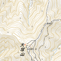
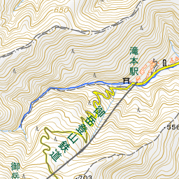
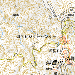
Take a bus for about 10 minutes from JR Mitake Station to the base of the cable car (Takimoto Station), then board the Mitake Tozan Railway cable car. It climbs an elevation difference of 424 meters from Takimoto Station (elevation 407 m) to Mitakesan Station (831 m) in 6 minutes. Its average gradient of 22 degrees is the steepest in the Kanto region. Climbing on foot takes about 60 minutes from the foot of the mountain to the summit. From Mitakesan Station to Musashi Mitake-jinja Shrine is about a 25-minute walk. The road is paved, but steep slopes continue once you enter the shukubo settlement, concluding with around 330 steps. Be sure to wear comfortable walking shoes. At the Mitake Visitor Center, you can obtain hiking maps and information on weather and trail conditions. Highlights on the mountain are introduced in the separate spot entries for Musashi Mitake-jinja Shrine, the Rock Garden, and Mt. Hinode.

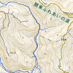
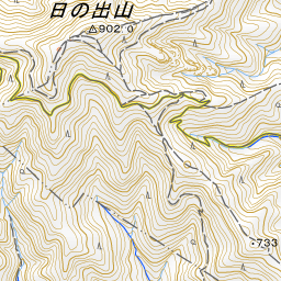
Spot location © OpenStreetMap contributors (ODbL)
Open in Google MapsGuides that include this spot (1)
Use asobot while you walk
- See where you are on the map and find spots nearby
- Listen to the guide's audio in course order, one after another (with subtitles)
- Walk to the next spot while following the map
Open on your phone
Scan to open this spot in asobot on your phone.