
Otokoyama Observation Deck
Japanese: 男山展望台
Yawata, Kyoto
This information was written by AI and may contain mistakes. Please check official sources for opening hours, fees, and other details before you go.
Found a mistake? Let us know with “✏️ Something's wrong” on this spot's screen in asobot →
🎧 Audio guide(0:57)
In short
An observatory atop Mt. Otokoyama, where Iwashimizu Hachimangu Shrine stands. Across the three rivers flowing in the foreground stretches the cityscape of Kyoto, with views that extend to Mt. Hiei and the mountain ridges of Uji, making it a scenic vantage point in Yawata.
- Three Rivers and the City of Kyoto: In the foreground flow three rivers, the Kizu River, Uji River, and Katsura River, with the Kyoto cityscape stretching out beyond them
- Mt. Tennozan to the West, Mt. Hiei to the East: To the west lies Mt. Tennozan, facing Mt. Otokoyama across the rivers, and to the east you can take in Mt. Hiei and the mountain ridges of Uji. Distant mountains can be seen on fine days
- Cherry Blossom and Autumn Foliage Seasons: During the cherry blossom and autumn foliage seasons, the view becomes even more vibrant
History and Highlights
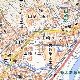
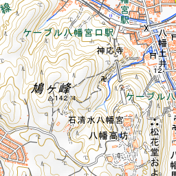
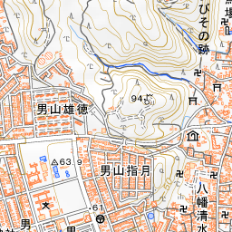
Otokoyama Observation Deck is an observatory located atop Mt. Otokoyama, where Iwashimizu Hachimangu Shrine is enshrined. Situated near Hachimangu-Sanjo Station on the Iwashimizu Hachimangu Sando Cable, it is reached by climbing the stairs from the station. Across the three rivers flowing in the foreground stretches the urban landscape of Kyoto, offering sweeping views that extend to Mt. Hiei and the mountain ridges of Uji, making it a scenic vantage point in Yawata.
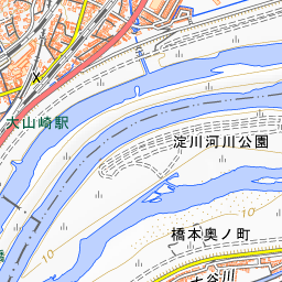
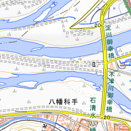
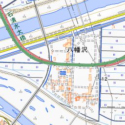
Mt. Otokoyama sits opposite Mt. Tennozan across the confluence where the Kizu River, Uji River, and Katsura River join to become the Yodo River, and has long been a vital transportation hub linking Kyoto and Naniwa. Standing at the observation deck, with the river currents and Kyoto's cityscape unfolding between Mt. Tennozan to the west and Mt. Hiei to the east, you can see from above the topography of this land cradled between mountains and rivers.
Viewing and Experience Points
- Three Rivers and the City of Kyoto: In the foreground flow three rivers—the Kizu River, Uji River, and Katsura River—with the Kyoto cityscape stretching out beyond them.
- Mt. Tennozan to the West, Mt. Hiei to the East: To the west lies Mt. Tennozan facing Mt. Otokoyama across the rivers, and to the east you can take in Mt. Hiei and the mountain ridges of Uji. Mt. Hiei lies to the northeast, and distant mountains can be seen clearly on fine days.
- Cherry Blossom and Autumn Foliage Seasons: During the cherry blossom and autumn foliage seasons, the panoramic view becomes even more vibrant.
Travel Tips
Get off at Iwashimizu-hachimangu Station on the Keihan Main Line and take the Sando Cable from Hachimangu-guchi Station up to Hachimangu-Sanjo Station. The cable car travels an elevation difference of about 82 meters in about 3 minutes, and views of Yawata, including the Sewaritei Embankment, can be enjoyed from the windows. The cars, themed around the relationship between the sun and the moon where one rises as the other sets, are also popular. If ascending on foot, taking either the Omotesando (front approach) or Urasando (rear approach) from beside Kora Shrine at the foot of the mountain takes about 20 minutes to reach the summit. The main shrine buildings of Iwashimizu Hachimangu Shrine are about a 5-minute walk from the observation deck. When descending along the Urasando on the return trip, passing the pine tree said to have been planted by Minamoto no Yoritomo, it takes about 25 minutes on foot to reach the station. The Edison Memorial Monument is also located near the San-no-Torii gate along the Omotesando.

Guides that include this spot (1)
Use asobot while you walk
- See where you are on the map and find spots nearby
- Listen to the guide's audio in course order, one after another (with subtitles)
- Walk to the next spot while following the map
Open on your phone
Scan to open this spot in asobot on your phone.