 ✨ AI Generated
Akigawa Valley
Japanese: 秋川渓谷
Akiruno, Tokyo
This information was written by AI and may contain mistakes. Please check official sources for opening hours, fees, and other details before you go.
Found a mistake? Let us know with “✏️ Something's wrong” on this spot's screen in asobot →
🎧 Audio guide(1:03)
In short
Akigawa Valley is a valley stretching approximately 20 km from Akiruno City to Hinohara Village. Created by the Aki River, which is said to be the largest tributary of the Tama River, it is located about an hour west of central Tokyo. It is known for its clear waters and mountain scenery that changes with the four seasons, such as fresh green leaves and autumn foliage. The lush greenery of Chichibu-Tama-Kai National Park extends across the entire area.
- Clear waters of the Aki River: The water is so transparent that you can trace the shadows of fish from atop the bridges.
- Ishibune Bridge and autumn foliage: In autumn, you can look out over the colorful valley from Ishibune Bridge, the symbol of the valley.
- Riverside outdoor activities: Along the valley, you can enjoy barbecues, camping, sweetfish (ayu) fishing, and mountain walking.
History & Highlights
The Aki River is said to be the largest tributary of the Tama River. The approximately 20 km section from around Ajiro in Akiruno City to the Kita-Aki River and Minami-Aki River in Hinohara Village is known as "Akigawa Valley." Although it is only about an hour west of central Tokyo, the lush natural landscape of Chichibu-Tama-Kai National Park spreads across the region.
The waters of the Aki River are remarkably clear, allowing you to trace the silhouettes of fish from bridges above. The river is home to species such as yamame trout, ayu (sweetfish), trout, and dace. The river's character varies by location, featuring shallow areas where even small children can paddle, gently flowing downstream sections, and upstream rapids splashing against large boulders.
Along the riverbanks, alongside planted Japanese cedars, deciduous trees extend their branches, adding color with fresh greenery and in autumn. In spring, murasaki-tsutsuji (purple azaleas) and cherry blossoms bloom, while fireflies dance about in the summer twilight. Fitting its name—"Autumn River"—the valley in autumn is painted with blazing red maples and golden foliage.
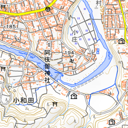
The symbol of the valley is Ishibune Bridge spanning the Aki River. Near the bridge lies the hot spring facility Akigawa Valley Seoto-no-Yu, where visitors can enjoy the autumn leaves while soaking in the hot springs.
Viewing & Experience Points
- Viewing Autumn Foliage: During the foliage season, many visitors come to Akigawa Valley every year. The autumn leaves around Jurigi are particularly spectacular, and the views from Ishibune Bridge are also well known. The best viewing time is from mid-November to early December.
- Playing by the River: Barbecue and camping sites are scattered along the valley, bustling with families playing in the water on weekends and holidays and during the peak travel seasons. When sweetfish fishing opens in early June, the Aki River fills with anglers.
- Walking through Mountain Villages: Akigawa Valley features gentle terrain, making it an easy place for walking. Well-developed walking trails wind through the surrounding mountains, attracting many hikers year-round.
Visiting Tips
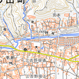
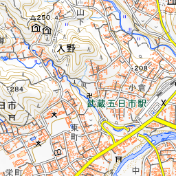
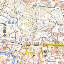
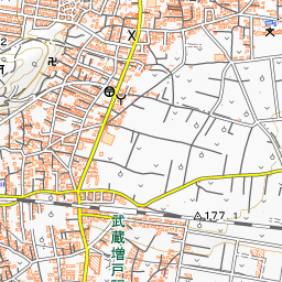
The gateway to the valley is Musashi-Itsukaichi Station, the terminal of the JR Itsukaichi Line. Taking a bus from the station to Jurigi allows you to cross Ishibune Bridge and walk along a woodland trail toward Seoto-no-Yu. On the north side of the valley stands Daihigan-ji Temple, while Kotoku-ji Temple is also cited as a popular autumn foliage spot. When playing in the river, be very cautious of sudden rises in water levels and lightning, and do not enter the water in areas where swimming is prohibited. When having barbecues, please do not light fires directly on the ground, and take your trash home with you.
Guides that include this spot (1)
Use asobot while you walk
- See where you are on the map and find spots nearby
- Listen to the guide's audio in course order, one after another (with subtitles)
- Walk to the next spot while following the map
Open on your phone
Scan to open this spot in asobot on your phone.