 ✨ AI Generated
Byobuiwa Rock
Japanese: 屏風岩
Kyotango, Kyoto
This information was written by AI and may contain mistakes. Please check official sources for opening hours, fees, and other details before you go.
Found a mistake? Let us know with “✏️ Something's wrong” on this spot's screen in asobot →
🎧 Audio guide(1:03)
In short
A 13-meter-tall monolith standing in the sea in Fudeishi, Tango-cho, Kyotango City. It gets its name because its appearance, rising straight up from the sea surface, looks like a folding screen (byobu) set upright. It is considered one of the scenic views representative of the northern coast of the Tango Peninsula, and it is also a highlight of the San'in Kaigan Geopark.
- The Straight Line of Rocks: Small rocks line up in a straight line before and after Byobuiwa Rock. The trace of magma intruding like a sheet remains as a single line across the sea
- Difference in Color Between Cliff and Rock: The coastal cliff behind is made of whitish strata of volcanic ash. Comparing it with the hard Byobuiwa Rock standing in front clearly reveals how the rock remained after being eroded by the waves
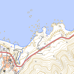
- View from the Observation Area: From the observation area atop a coastal terrace in Fudeishi along National Route 178, you can view Byobuiwa Rock and the line of small islands extending offshore. In winter, waves on the Sea of Japan are often high, so do not go down close to the sea, but view it from the observation area
History and Highlights
Byobuiwa Rock is a 13-meter-tall monolith standing in the sea in Fudeishi, Tango-cho, Kyotango City. It gets its name because its appearance, rising straight up from the sea surface in front of the coastal cliff, looks like an unfolded folding screen (byobu).
To the northwest of Byobuiwa Rock, several small rocks line up in a straight line. This arrangement reveals the origin of Byobuiwa Rock. In this area, there are whitish strata of volcanic ash and other materials that accumulated about 15 million years ago. Underground magma intruded like a sheet into these strata, cooling and solidifying into a hard rock called dacite. Over many years, the softer surrounding strata were eroded away by the waves, leaving behind only the hard rock portion. In this way, the screen-like rock and the line of small islands were formed.
The view of Byobuiwa Rock is considered one of the scenic views representative of the northern coast of the Tango Peninsula, and it is also a highlight of the San'in Kaigan Geopark.
Viewing and Experience Points
- The Straight Line of Rocks: Pay attention to the small rocks lined up before and after Byobuiwa Rock. The trace of magma intruding like a sheet remains as a single line across the sea.
- Difference in Color Between Cliff and Rock: The coastal cliff behind is made of whitish strata of volcanic ash. Comparing it with the hard Byobuiwa Rock standing in front reveals how the rock remained after being eroded by the waves.
- As Part of Tango-cho's Coastal Scenery: Together with Tango Matsushima and Cape Kyoga to the east, and Tateiwa Rock to the west, Byobuiwa Rock is registered as a Kyoto Prefecture Landscape Asset under the title "Coastal Landscape of Tango's Tateiwa, Byobuiwa, Tango Matsushima, and Cape Kyoga."
Walking Tips
Byobuiwa Rock can be viewed from an observation area along National Route 178. The observation area sits atop a coastal terrace in Fudeishi, offering views of Byobuiwa Rock and the line of small islands extending offshore. It is an easy place to stop by while touring the Tango Peninsula by car.
In winter, waves on the Sea of Japan are often high, so do not go down close to the sea, but view it from the observation area. Traveling west leads to Tateiwa Rock towering at the mouth of the Takeno River, and heading east leads to Tango Matsushima Observation Point, allowing you to enjoy the coastal scenery of Tango-cho together.




Use asobot while you walk
- See where you are on the map and find spots nearby
- Listen to the guide's audio in course order, one after another (with subtitles)
- Walk to the next spot while following the map
Open on your phone
Scan to open this spot in asobot on your phone.