 ✨ AI Generated
Mt. Tenjo
Japanese: 天上山
Kozushima Village, Tokyo
This information was written by AI and may contain mistakes. Please check official sources for opening hours, fees, and other details before you go.
Found a mistake? Let us know with “✏️ Something's wrong” on this spot's screen in asobot →
🎧 Audio guide(1:02)
In short
Mt. Tenjo is a 572-meter-high mountain towering in the center of Kozushima Island. It is a trapezoidal mountain readily recognizable from the sea, and has been selected as one of Japan's "100 Famous Mountains of Flowers" and "New 100 Famous Mountains of Japan." Its summit area features expanses of white sand and ponds, and is home to a legend that the gods of the Izu Islands gathered here to discuss the distribution of water.
- Fudo Pond: A pond that forms a heart shape when rain fills it with water, featuring a shrine in its center dedicated to the dragon god (Ryujin).
- Omote-sabaku and Ura-sabaku Deserts: Expanses of white sand spreading across the summit area, offering a striking contrast between the white sand and steep craggy rocks.
- Kuroshio Grand Observation Deck: The view from the summit is designated as one of the "New Hundred Views of Tokyo," and on clear days, Mt. Fuji can be seen in the distance.
History and Highlights
Mt. Tenjo is a 572-meter-high mountain rising in the center of Kozushima Island. It is a trapezoidal mountain easily identified from out at sea; although it is an "island mountain," it possesses the rugged atmosphere of a deep mountain range. Formed by a major volcanic eruption in the 5th year of the Jowa era (838), it has long been revered by the islanders as a sacred mountain.
Throughout the year, flowers bloom across the summit area, including species endemic to the Izu Islands. It has been selected for the "100 Famous Mountains of Flowers," the "New 100 Famous Mountains of Japan," and the "100 Famous Mountains of Kanto." Near the summit from May to early June, visitors can see Oshima azaleas, the signature flower of Kozushima Island. The view from the top is also magnificent, selected as one of the "New Hundred Views of Tokyo" as the Kuroshio Grand Observation Deck.
A myth is associated with Hairanaigasawa, a large depression located in the summit area. It is said that the gods of the Izu Islands gathered here to discuss the division of water. The water was allocated on a first-come, first-served basis, leaving almost none for the god of Toshima Island, who arrived last. Legend has it that the angered god jumped into the remaining water and thrashed about, causing water to gush forth across Kozushima Island. Even today, Hairanaigasawa remains a sacred ground where entry is prohibited.
Tips for Viewing and Experiencing
- Fudo Pond: A pond that becomes heart-shaped when rainwater collects. Historically an object of faith for the island's fishermen, a shrine enshrining the dragon god still stands in the center of the pond.
- Omote-sabaku and Ura-sabaku Deserts: There are two white-sand deserts in the summit area. Omote-sabaku Desert offers a stunning combination of colors between the white sand and precipitous rocks. From the Ura-sabaku Desert observation point, one can look out toward Miyakejima Island and Mikurajima Island across the cliffs below.
- View from the Summit: The New Hundred Views of Tokyo Observation Point is a scenic spot chosen among the New Hundred Views of Tokyo, offering panoramic views of the Izu Islands. If the weather permits, Mt. Fuji can also be seen in the distance above the horizon. Near the 10th station of the Kuroshima summit, the remains of the Orosha stone walls, built during the Edo period for coastal defense, can also be found.
Walking Tips
It takes about 40 minutes on foot from Kozushima Port to the respective trailheads at Kuroshima and Shiroshima. It is common to ascend via the Kuroshima Trail and descend via the Shiroshima Trail, with the two trails merging at Omote-sabaku Desert. From the Kuroshima trailhead to the 10th station of the summit, there is a direct climb with an elevation gain of 280 meters, so take care not to rush. Courses ranging from approximately 4 to 6 hours are maintained for hikers of all levels, from beginners to advanced. While climbing is possible throughout the year, please descend before sunset for safety. Mountain entry at night is prohibited. Spring, when colored by Oshima azaleas, and autumn, when gentians are beautiful, are especially recommended. Information on ocean activities is provided under the Akasaki Promenade spot.
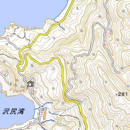
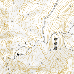
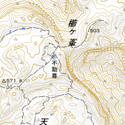
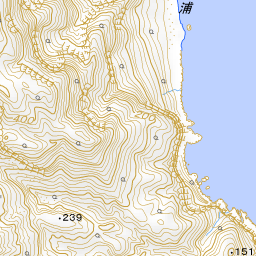


Spot location © OpenStreetMap contributors (ODbL)
Open in Google MapsGuides that include this spot (1)
Use asobot while you walk
- See where you are on the map and find spots nearby
- Listen to the guide's audio in course order, one after another (with subtitles)
- Walk to the next spot while following the map
Open on your phone
Scan to open this spot in asobot on your phone.