 ✨ AI Generated
Mt. Kumotori
Japanese: 雲取山
Okutama Town, Tokyo
This information was written by AI and may contain mistakes. Please check official sources for opening hours, fees, and other details before you go.
Found a mistake? Let us know with “✏️ Something's wrong” on this spot's screen in asobot →
🎧 Audio guide(1:06)
In short
Mt. Kumotori stands at an elevation of 2,017 meters on the border of Tokyo, Saitama, and Yamanashi Prefectures, and is the highest peak in Tokyo. It is one of Japan's 100 Famous Mountains and is located almost in the center of Chichibu-Tama-Kai National Park. With a mountain hut near the summit, many people climb it as a 2-day, 1-night trip.
- Nearly 360-degree views: From the summit, you can overlook Mt. Fuji, the Southern Alps, and toward central Tokyo.
- 201.7 cm summit marker: A granite marker stands at a height corresponding to the mountain's elevation.
- Mountain journey with an overnight stay: Because the one-way hiking time exceeds 5 hours, planning an overnight stay at a mountain hut or tent site is recommended.
History and Highlights
Mt. Kumotori is a 2,017-meter mountain spanning the borders of Tokyo, Saitama, and Yamanashi Prefectures. It is the highest peak in Tokyo and is also selected as one of Japan's 100 Famous Mountains. Located at the eastern edge of the Okuchichibu Mountains, it sits almost in the center of Chichibu-Tama-Kai National Park.
There are several theories regarding the origin of the mountain's name. One theory suggests that it comes from being a high mountain towering above the clouds, giving the impression that "one could almost catch the clouds."
Primeval forests of Veitch's fir and birch species spread around the summit, inhabited by wild animals such as sika deer and Asian black bears. The Tokyo and Yamanashi sides are managed as Tokyo's water conservation forest. As part of the Tama River basin, it plays an important role as a water source for the Tokyo metropolitan area.
The summit marker was renewed jointly by Tokyo and Saitama Prefecture on August 11, 2016, in commemoration of "Mountain Day," a national holiday that began that year. Made of granite, it stands 201.7 centimeters tall, a height taken from the mountain's elevation. Just below the summit is a relief of Tomita Jisaburo, the first hut keeper of Kumotori Sanso, who was called the "Sickle Hermit." He is said to have cleared the mountain trail known as the Tomita Shindo using a sickle.
Points to See and Experience
- View from the summit: From the summit, you can gaze at Mt. Fuji to the southwest and the peaks of the Southern Alps to the west. A nearly 360-degree panorama stretches toward the direction of central Tokyo.
- Seasonal flowers: In spring and summer, colorful wildflowers bloom.
- Summit marker: Standing before the 201.7 cm marker matching the elevation, you can confirm that you are standing at the highest point in Tokyo.
Tips for Visiting
Climbing routes include a course via Mt. Shiraiwa from Mitsumine-jinja Shrine in Saitama Prefecture, a course via Sanjo-darumi from Sanjo-no-yu in Tabayama Village in Yamanashi Prefecture, and a course via Mt. Nanatsuishi from Kamosawa in Okutama Town, Tokyo. Kamosawa is about 34 minutes by bus bound for Taba or Kamosawa-nishi from bus stop No. 2 at Okutama Station on the JR Ome Line. The course from Kamosawa covers a walking distance of about 10.7 km, with an estimated one-way moving time of 6 hours and 20 minutes. There is a mountain hut near the summit, and a 2-day, 1-night itinerary is standard for all courses. Because the one-way hiking time exceeds 5 hours, taking a trip that includes an overnight stay in a mountain hut or tent is recommended. Places to stay include Kumotori Sanso, Nanatsuishi Hut, Sanjo-no-yu, and Gojunindaira campsite. The hiking courses are of intermediate to advanced level. Please carry basic equipment such as a headlamp, mountain map, and rainwear, and aim to arrive at the trailhead by 9:00 a.m. Climbing registration boxes are located at JR Ome Line stations and other spots, not at the trailheads.
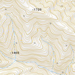


Spot location © OpenStreetMap contributors (ODbL)
Open in Google MapsUse asobot while you walk
- See where you are on the map and find spots nearby
- Listen to the guide's audio in course order, one after another (with subtitles)
- Walk to the next spot while following the map
Open on your phone
Scan to open this spot in asobot on your phone.