 ✨ AI Generated
Mitsujo Kofun Burial Mound
Japanese: 三ツ城古墳
Higashihiroshima, Hiroshima
This information was written by AI and may contain mistakes. Please check official sources for opening hours, fees, and other details before you go.
Found a mistake? Let us know with “✏️ Something's wrong” on this spot's screen in asobot →
🎧 Audio guide(0:59)
In short
Mitsujo Kofun Burial Mound is a group of three burial mounds located in Saijo Chuo, Higashihiroshima City, and all three mounds were designated as a National Historic Site in 1982. The largest, Mound No. 1, is a keyhole-shaped burial mound with a total length of about 92 meters, constructed in the first half of the 5th century, and it is the largest in Hiroshima Prefecture.
- Mounds Restored to Their Original Appearance: Based on the results of archaeological excavations, the mound was restored to its original appearance, and the site has been open to the public since 1994. Visitors can see the slopes covered with paving stones and the reconstructed rows of haniwa
- The Chieftain's Burial Facility: Three burial facilities were discovered in the round rear portion, unearthing bronze mirrors, necklaces, iron swords, and other items. The man buried in the burial facility at the center of the rear portion is thought to have been a chieftain who ruled the western part of Hiroshima Prefecture and belonged to the Yamato Regime
- Climbing from the Base to Feel the Scale: The site is maintained as a park, allowing visitors to walk up from the foot of the mound and experience the size of the keyhole-shaped mound under their own feet
History and Highlights
Mitsujo Kofun Burial Mound is a group of three burial mounds located in Saijo Chuo, Higashihiroshima City. Built at the tip of a hill extending from Mt. Hachiman to the south, all three mounds were designated as a National Historic Site in 1982.
The largest, Mound No. 1, is a keyhole-shaped burial mound (zenpo-koen-fun) with a total length of about 92 meters, making it the largest in Hiroshima Prefecture. It was constructed in the first half of the 5th century. The mound was built in three tiers, with haniwa (terracotta clay figures) arranged in rows on each tier, and the slopes of the upper two tiers were covered with fukiishi (paving stones). There were over 1,800 haniwa in total; in addition to cylindrical haniwa, figurative haniwa shaped like chickens, water birds, helmets, and cuirasses were placed on the rectangular front portion, while house-shaped haniwa were set on the round rear portion.
Three burial facilities were discovered in the round rear portion, unearthing bronze mirrors, necklaces, and iron swords. The man buried in the most elaborate burial facility at the center of the rear portion is thought to have been a chieftain who ruled the western part of Hiroshima Prefecture and belonged to the Yamato Regime. The nearby Mound No. 2 is also a round burial mound from the first half of the 5th century, believed to have been built before Mound No. 1, while Mound No. 3 is considered to date to around the first half of the 6th century.
Highlights of Appreciation and Experience
- Mounds Restored to Their Original Appearance: Based on the results of archaeological excavations, preservation and restoration work was carried out from fiscal 1990 to fiscal 1993, and the site has been open to the public since 1994. Visitors can see the slopes covered with paving stones and the reconstructed rows of haniwa.
- The Tsukuridashi Projections at the Constriction and the Surrounding Moat: Square projections known as tsukuridashi, thought to have served as altars, are located on both sides of the narrow constriction connecting the front and rear portions. A surrounding moat with a depth of about 1 meter encircles the burial mound.
- Climbing from the Base to Feel the Scale: The site is maintained as a park, allowing visitors to walk up from the foot of the mound. Take the opportunity to experience the size of this keyhole-shaped mound with a total length of about 92 meters under your own feet.
Tips for Walking Around
The excavated grave goods and haniwa are introduced in the guidance corner of the Higashihiroshima City Central Library, located just east of the mounds. Stopping by along with your visit to the mounds makes it easier to visualize the rows of haniwa that once stood on the mound and the lives of those who were buried there. The mounds are situated in an urban area within walking distance southwest of JR Saijo Station, and can easily be visited in conjunction with Saijo Sakagura-dori Street.
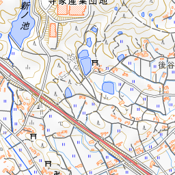


Spot location © OpenStreetMap contributors (ODbL)
Open in Google MapsUse asobot while you walk
- See where you are on the map and find spots nearby
- Listen to the guide's audio in course order, one after another (with subtitles)
- Walk to the next spot while following the map
Open on your phone
Scan to open this spot in asobot on your phone.