 ✨ AI Generated
Tempozan Park
Japanese: 天保山公園
Minato Ward, Osaka
This information was written by AI and may contain mistakes. Please check official sources for opening hours, fees, and other details before you go.
Found a mistake? Let us know with “✏️ Something's wrong” on this spot's screen in asobot →
🎧 Audio guide(1:09)
In short
A park located in Chikko, Minato Ward, Osaka City, home to Mount Tempozan, which stands at an elevation of 4.53 meters. Tempozan is an artificial mountain created by piling up earth and sand dredged from the riverbed during the dredging of the Aji River carried out from 1831 (Tempo 2) into the following year, and it is still the lowest mountain in Japan with a second-class triangulation point.
- Tempozan Summit: The second-class triangulation point sits among shrubs overlooking the Aji River, accompanied by a sign that reads "Tempozan Summit." Standing right next to it is the "Monument of Emperor Meiji's Naval Review" (Meiji Tenno Kankan no Shohi)
- Bustling Days and the History of the Battery: It bustled as a "new famous spot of Naniwa," but in 1854, when the Russian warship Diana appeared offshore, the shogunate cut down the recreational pine and cherry trees and cut away the mountain to build an artillery battery
- Ceramic Tile Art and Observation Deck: There are ceramic tile reproductions of the "Great Dredging" from the Tempozan Meisho Zue and of "Osaka Tempozan" by Utagawa Hiroshige I. From the observation deck in the center of the park, you can see the Tempozan Ohashi Bridge
History and Highlights
Tempozan Park is a park located in Chikko, Minato Ward, Osaka City, and is home to Mount Tempozan, which stands at an elevation of 4.53 meters. Tempozan is an artificial mountain created between 1831 (Tempo 2) and the following year by piling up earth and sand dredged from the riverbed during a large-scale dredging operation of the Aji River ordered by the shogunate. The project took nearly two years, funded by donations from citizens and carried out using massive manpower involving thousands of people daily.
Upon completion, the mountain stood about 20 meters high and came to be called "Mejirushi-yama" (Marker Mountain) because it served as a landmark for incoming and outgoing ships. Cherry trees and pine trees were planted, and it bustled as a "new famous spot of Naniwa (Osaka)," offering cherry blossom viewing in spring, boating in summer, moon viewing in autumn, and snow viewing in winter. However, in 1854, when the Russian warship Diana appeared offshore, the shogunate cut down the recreational pine and cherry trees and cut away part of the mountain to build an artillery battery. In 1868 (the first year of the Meiji period), Japan's first naval review was held off the coast of Tempozan.
Afterward, the mountain became lower due to factors such as ground subsidence; it was about 9 meters high when a second-class triangulation point was placed there in 1911, and it reached its current height of 4.53 meters in 1986. For a long time, it was popularly known as "Japan's lowest mountain," but it ceded that title when Mount Hiyoriyama in Sendai City was reduced to an elevation of 3 meters by the tsunami of the 2011 Great East Japan Earthquake. Nevertheless, it remains the lowest mountain in Japan with a second-class triangulation point. The park was developed in 1958, with pine and cherry trees replanted, reviving it as a leisure area.
Sights and Activities
- Tempozan Summit: The second-class triangulation point sits among shrubs overlooking the Aji River, accompanied by a sign that reads "Tempozan Summit."
- Monument of Emperor Meiji's Naval Review: Standing right next to the summit is the "Monument of Emperor Meiji's Naval Review" (Meiji Tenno Kankan no Shohi), which commemorates Emperor Meiji inspecting the new government's warships at Tempozan in the first year of the Meiji period.
- Ceramic Tile Art and Observation Deck: Inside the park are ceramic tile reproductions depicting the "Great Dredging" from the Tempozan Meisho Zue (Illustrated Guide to Famous Sights of Tempozan) and "Osaka Tempozan" by Utagawa Hiroshige I. In the center of the park is an observation deck that stands taller than Tempozan itself, offering views of the Tempozan Ohashi Bridge connecting Chikko in Minato Ward with Sakurajima in Konohana Ward.
Visitor Tips
The park is about 400 meters north of Osakako Station on the Osaka Metro Chuo Line, roughly a 7-minute walk. It is a hidden gem well known among cherry blossom enthusiasts. Right next to the park is the Tempozan Ferry terminal, which connects to the opposite bank at Sakurajima free of charge. You can also easily combine your trip with visits to the Tempozan Giant Ferris Wheel (about 210 meters southwest), the Tempozan Marketplace (about 270 meters southwest), and the Osaka Aquarium Kaiyukan (about 400 meters southwest).
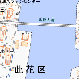


Spot location © OpenStreetMap contributors (ODbL)
Open in Google MapsUse asobot while you walk
- See where you are on the map and find spots nearby
- Listen to the guide's audio in course order, one after another (with subtitles)
- Walk to the next spot while following the map
Open on your phone
Scan to open this spot in asobot on your phone.